
Explore Mt Kilimanjaro Map Africa
Mt Kilimanjaro Map Africa
Explore our detailed Mt Kilimanjaro map Africa, showing all seven official climbing routes, campsites, mountain huts, park gates, elevations and summit landmarks. Download the printable map, compare every route and start planning your Kilimanjaro climb with confidence.
Click the map to view the full-size original in the lightbox, or download the printable PDF for planning your Kilimanjaro climb.
Understanding the Mt Kilimanjaro Map
How to Read the Mt Kilimanjaro Map Africa
Our detailed Mt Kilimanjaro map Africa shows how the seven official climbing routes, campsites, mountain huts, park gates, elevations and summit landmarks fit together. Understanding these features makes it easier to compare routes and choose an itinerary that suits your available time, hiking experience and acclimatisation needs.
Route Colours
Seven Official Routes
Each coloured line represents a different Kilimanjaro climbing route. The map shows where each trail begins, where routes merge and how they continue towards Uhuru Peak.
Campsites, Huts & Gates
Where Each Day Begins and Ends
Campsites, Marangu mountain huts and park gates help you follow the daily progression of each route and see where hikers enter the park, stay overnight and complete their trek.
Elevations
Altitude and Summit Landmarks
Elevation markers show how quickly each route gains altitude. Key landmarks include Lava Tower, Gilman’s Point, Stella Point and Uhuru Peak, the summit of Mount Kilimanjaro at 5,895 metres.
Route Planning
Compare How the Routes Connect
Several routes merge as they cross the mountain. For example, Lemosho joins the Machame trail before both continue along the Southern Circuit through Barranco, Karanga and Barafu towards the summit.
Compare Climbing Routes
Which Kilimanjaro Route Is Right for You?
Our Mount Kilimanjaro map displays all seven official climbing routes to the summit. Below we've compared the six routes most hikers consider, highlighting the scenery, accommodation, acclimatisation, recommended itinerary and who each route is best suited for.
Western Approach
Lemosho Route
Best for scenery and acclimatisation- Recommended
- 8 days
- Start
- Londorossi Gate
- Accommodation
- Camping
- Difficulty
- Moderate
- Total Distance
- Approx. 67 km / 42 mi
Our most recommended route. Lemosho offers outstanding scenery, excellent acclimatisation and one of the highest summit success rates thanks to its gradual western approach.
View Lemosho Route →Southern Approach
Machame Route
Popular, scenic and well balanced- Recommended
- 7 days
- Start
- Machame Gate
- Accommodation
- Camping
- Difficulty
- Moderate
- Total Distance
- Approx. 61 km / 38 mi
Excellent value for hikers wanting spectacular scenery, strong acclimatisation and a shorter itinerary than Lemosho.
View Machame Route →Eastern Approach
Marangu Route
The only route using mountain huts- Recommended
- 6 days
- Start
- Marangu Gate
- Accommodation
- Huts
- Difficulty
- Moderate
- Total Distance
- Approx. 74 km / 46 mi
The only Kilimanjaro route using permanent mountain huts instead of tents. A good option during wetter months and for hikers preferring hut accommodation.
Explore Marangu Route →Northern Approach
Rongai Route
Quiet Northern Route- Recommended
- 7 days
- Start
- Nalemoru Gate
- Accommodation
- Camping
- Difficulty
- Moderate
- Total Distance
- Approx. 74 km / 46 mi
A quieter route with fewer hikers, approaching Kilimanjaro from the northern side before descending via the Marangu Route.
Explore Rongai Route →Northern Circuit
Northern Circuit Route
Best Acclimatisation- Recommended
- 9 days
- Start
- Londorossi Gate
- Accommodation
- Camping
- Difficulty
- Moderate
- Total Distance
- Approx. 90 km / 56 mi
A long and remote itinerary that circles the northern slopes through Moir, Pofu and Third Cave before approaching the summit from the east.
Explore Northern Circuit →Southern Approach
Umbwe Route
Steepest Route- Recommended
- 7 days
- Start
- Umbwe Gate
- Accommodation
- Camping
- Difficulty
- Challenging
- Total Distance
- Approx. 48 km / 30 mi
A steep route for experienced trekkers. It joins the Southern Circuit and continues through Barranco, Karanga and Barafu.
Explore Umbwe Route →Campsites & Mountain Huts
Campsites and Huts on the Mount Kilimanjaro Map
The Mount Kilimanjaro map shows every campsite and mountain hut used along the seven official climbing routes. Their locations and elevations explain how each itinerary progresses across the mountain, where hikers sleep each night and how altitude gradually increases during the climb. Every overnight stop shown on the Mt Kilimanjaro map is where hikers sleep during their climb, either in mountain huts or camping tents depending on the route.
Featured Locations
Most Important Camps and Huts
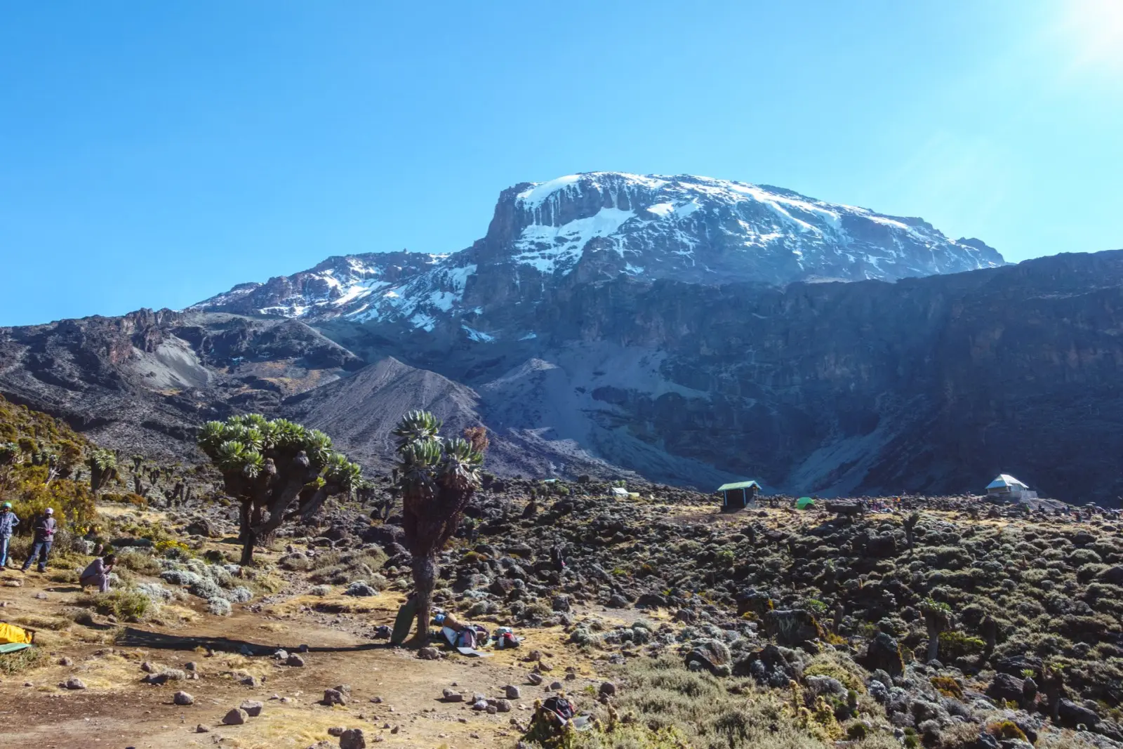
Barranco Camp
One of Kilimanjaro's most famous campsites, located below the Barranco Wall with spectacular glacier and valley views.
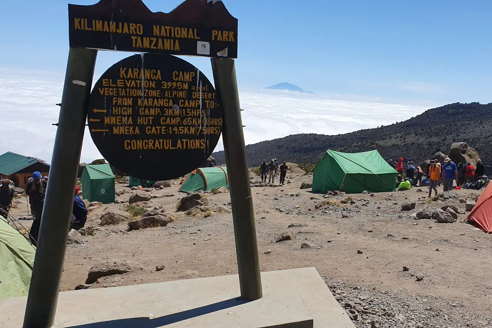
Karanga Camp
The final acclimatisation campsite before Barafu, giving hikers another night to adjust to the altitude.
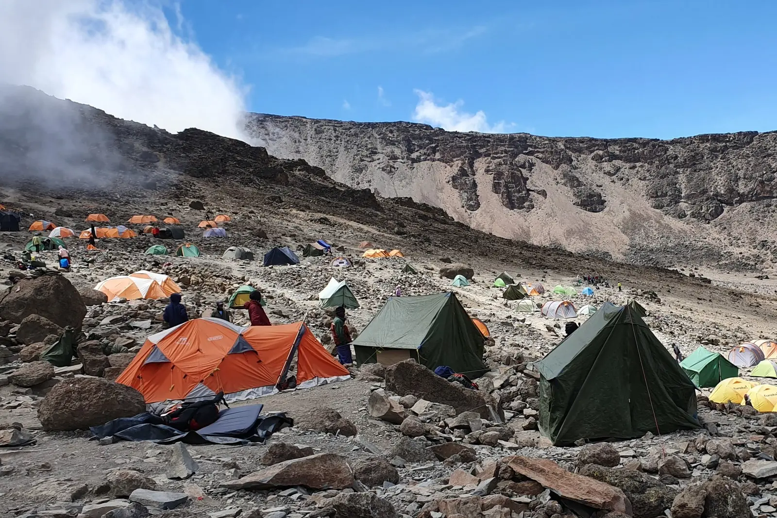
Barafu Camp
The main summit base camp where most climbers begin their midnight ascent to Uhuru Peak.
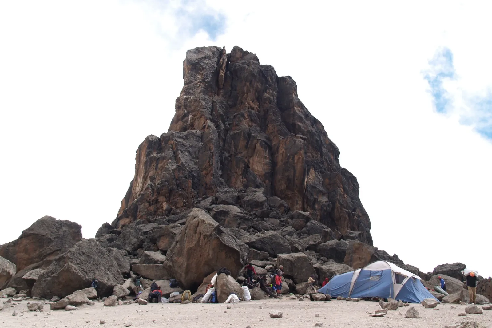
Lava Tower
A major acclimatisation landmark where hikers climb high before descending to a lower overnight camp.
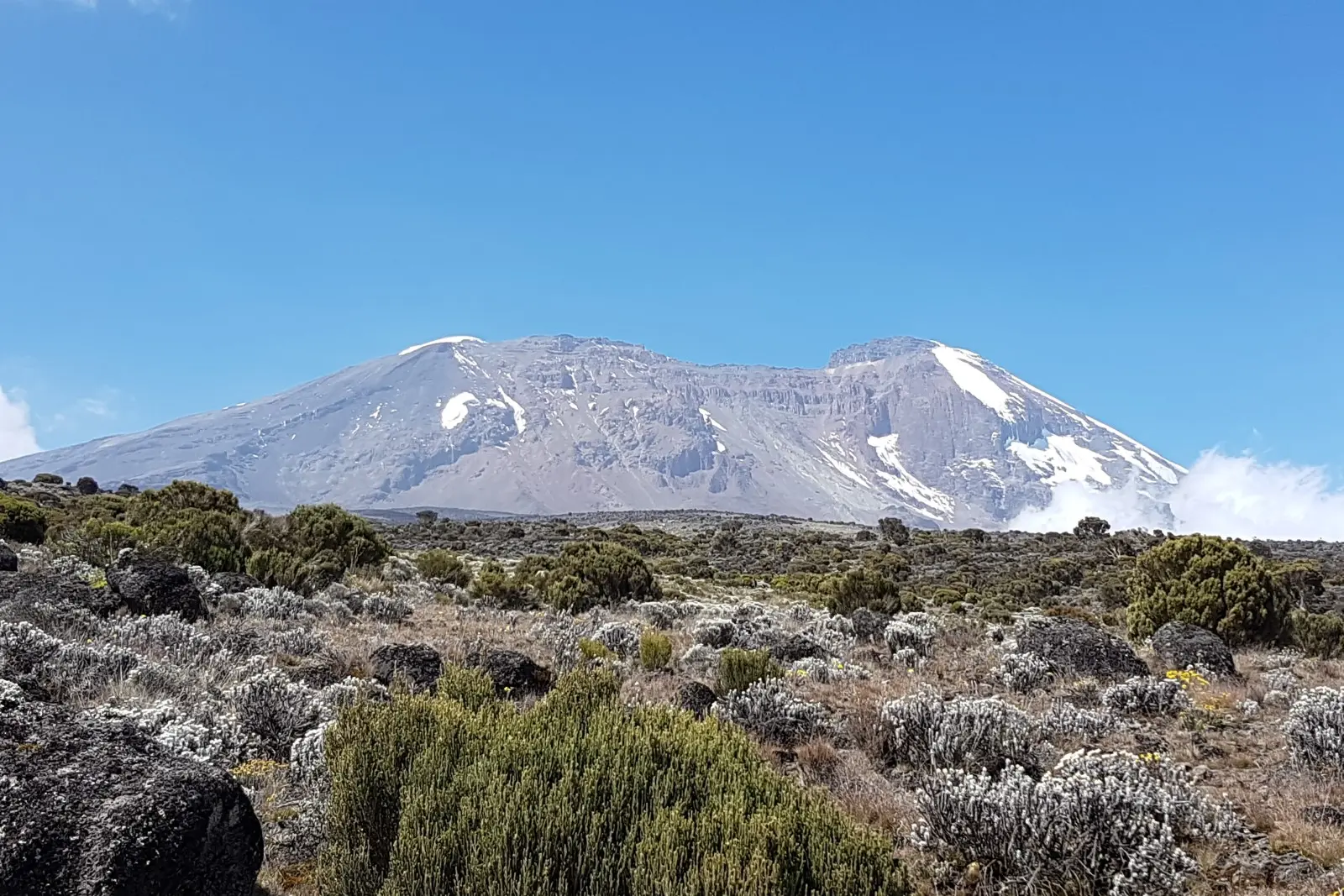
Shira 2 Camp
A scenic campsite on the Shira Plateau, often used before the acclimatisation hike to Lava Tower.
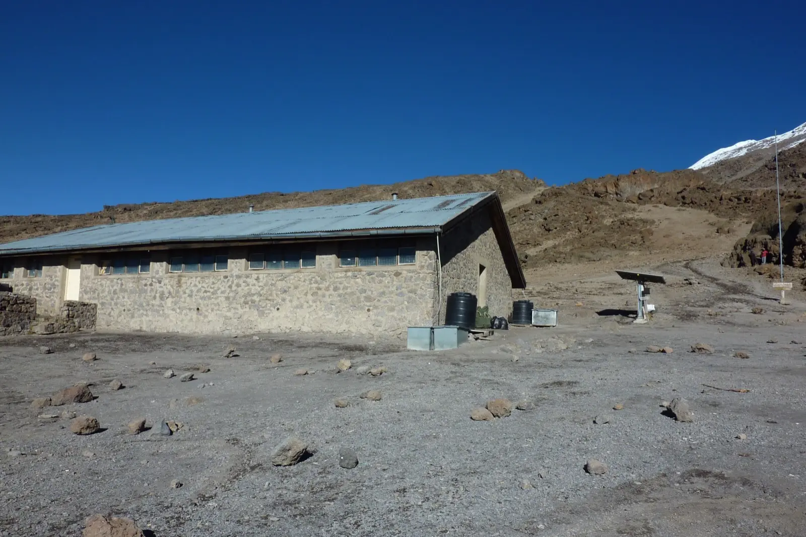
Kibo Hut
The highest mountain hut on Kilimanjaro and the starting point for the Marangu Route summit attempt.
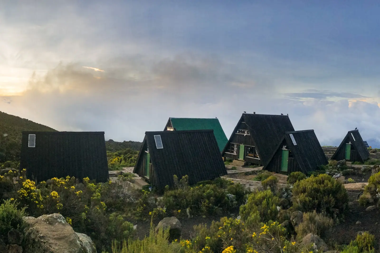
Horombo Huts
The largest mountain hut complex on Kilimanjaro, used for both acclimatisation and descent on the Marangu Route.
Other Camps Along the Routes
Additional Campsites and Mountain Huts
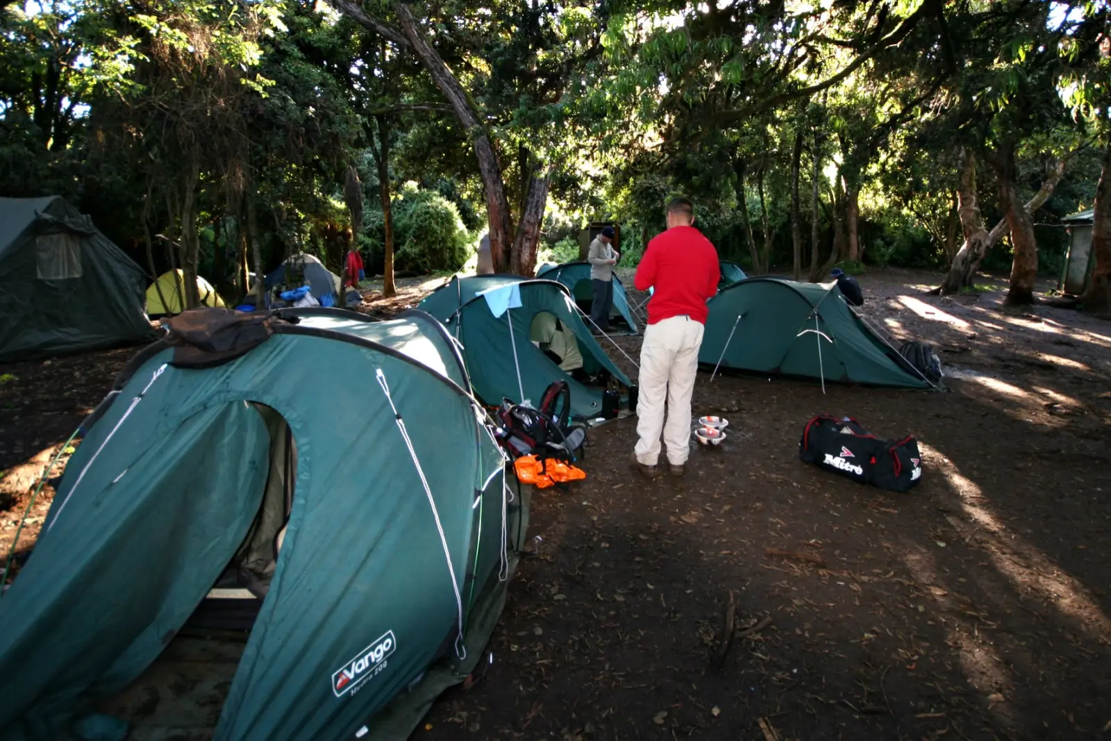
Big Tree Camp
The first overnight camp on the Lemosho Route, surrounded by lush montane rainforest.
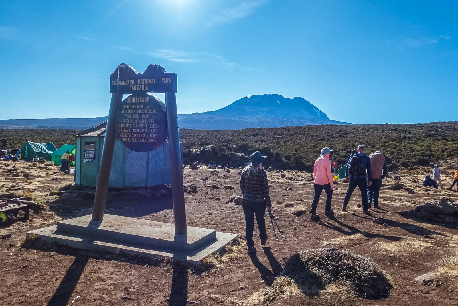
Shira 1 Camp
A broad plateau campsite with open views across the Shira landscape and towards Kibo.
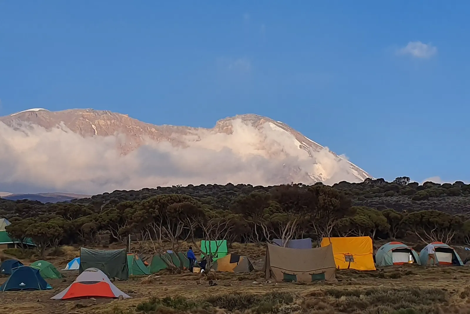
Shira Cave Camp
A campsite on the Shira Plateau near the historic cave once used by early climbers.
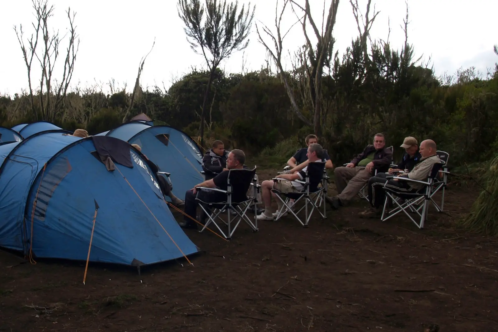
Machame Camp
The first overnight campsite after entering through Machame Gate and climbing through dense rainforest.
Millennium Camp
A high descent campsite sometimes used after the summit before continuing towards Mweka Gate.
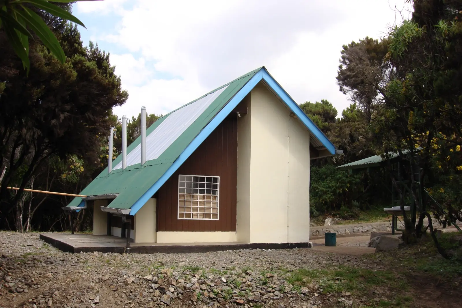
Mweka Camp
The main overnight descent camp used after summiting via Barafu and Stella Point.
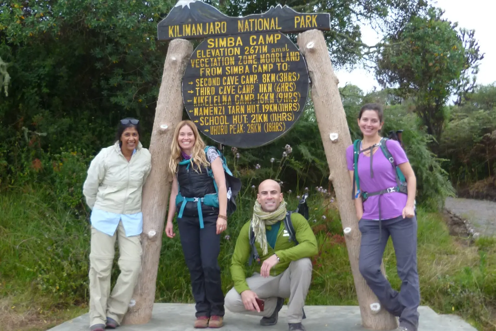
Simba Camp
The first campsite on the quieter northern Rongai Route, with excellent views across Kenya.
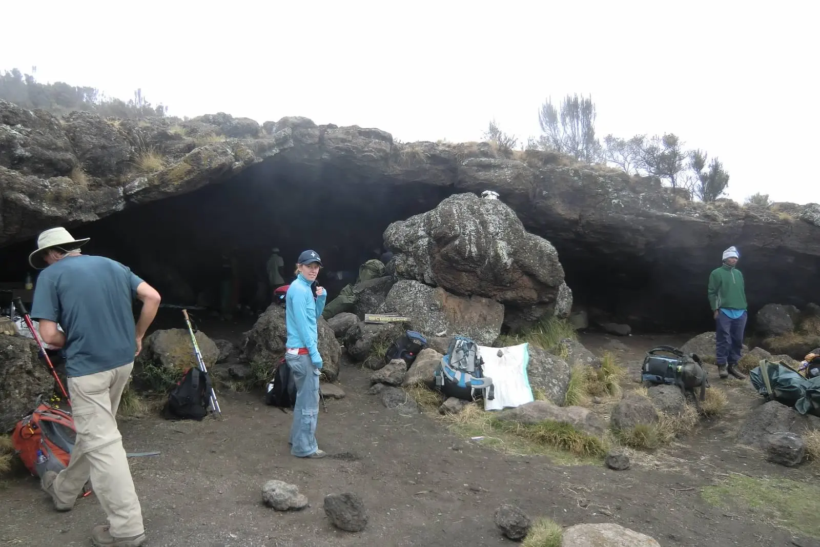
Second Cave Camp
An open moorland campsite with views towards Kibo and the eastern ice fields.
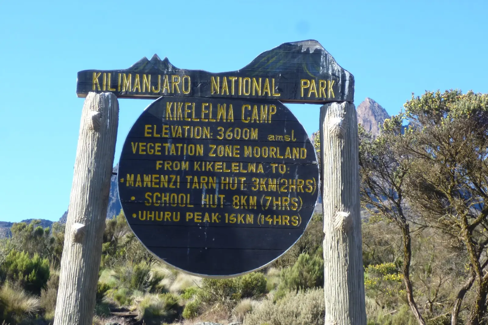
Kikelewa Camp
A quiet campsite positioned beneath the rugged slopes of the Mawenzi massif.
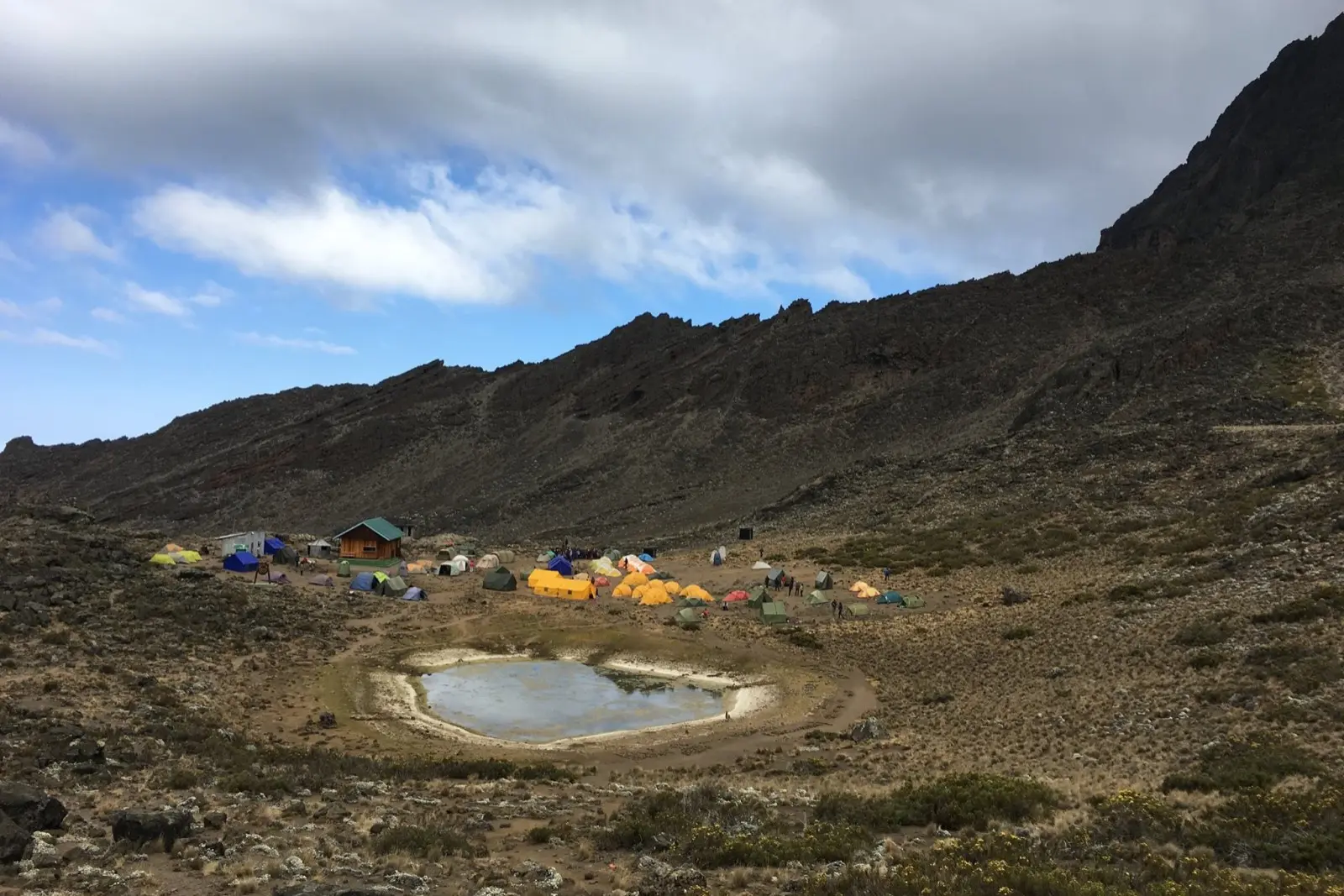
Mawenzi Tarn Camp
A striking high-altitude campsite in a sheltered basin below Mawenzi Peak.
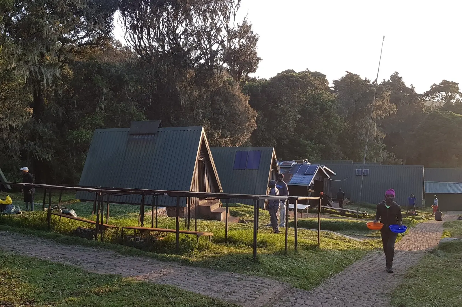
Mandara Huts
The first mountain huts reached after entering through Marangu Gate and trekking through the rainforest.
Choose the Right Kilimanjaro Route
Which Kilimanjaro Route Is Right for You?
The Mt Kilimanjaro map helps you compare where each route begins, how the trails connect and which camps are used. Below we've highlighted the routes we recommend most often, together with quieter and more specialised alternatives, helping you choose the itinerary that best matches your available time, experience, preferred accommodation and acclimatisation needs.
Our Three Most Recommended Routes
Lemosho, Machame and Marangu
These are the three routes we recommend most often because they provide the best combination of scenery, acclimatisation, value and accommodation options for most hikers.
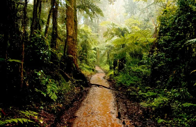
Scenic • Gradual • Excellent Acclimatisation
8-Day Lemosho Route
Approx. 67 km / 42 mi
Our most recommended route, offering spectacular scenery, excellent acclimatisation and one of the highest summit success rates on Kilimanjaro.
- Excellent acclimatisation profile
- Quieter western approach
- Scenic Shira Plateau and Southern Circuit
- Excellent for first-time Kilimanjaro climbers
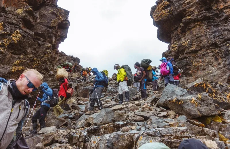
Popular • Varied • Strong Value
7-Day Machame Route
Approx. 61 km / 38 mi
Excellent value for hikers looking for spectacular scenery, strong acclimatisation and a shorter itinerary than Lemosho.
- Good acclimatisation on the 7-day itinerary
- Popular and scenic Southern Circuit route
- Shorter and more affordable than Lemosho
- Excellent choice for fit and active hikers
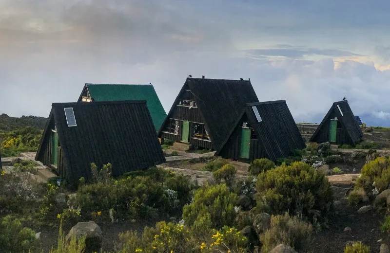
Huts • Direct Route • Rainy-Season Option
6-Day Marangu Route
Approx. 74 km / 46 mi
The only Kilimanjaro route offering permanent mountain huts instead of camping, making it popular with hikers who prefer indoor accommodation.
- Permanent hut accommodation
- Often preferred during wetter periods
- Uses the same trail for ascent and descent
- Best suited to hikers who prefer not to camp
Other Official Routes
Specialist Kilimanjaro Route Options
These routes are best suited to hikers looking for quieter trails, maximum acclimatisation time or a steeper and more demanding climb.
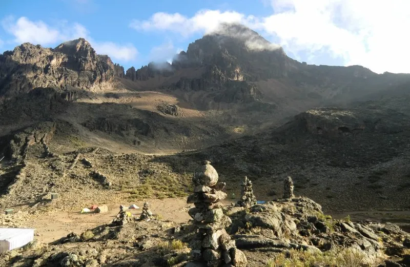
Quiet • Northern Approach • Drier Slopes
7-Day Rongai Route
Approx. 74 km / 46 mi
A quieter approach from Kilimanjaro's northern side, often chosen during wetter months because this side of the mountain generally receives less rainfall.
- Less crowded northern trail
- Gradual ascent towards Mawenzi
- Distinct scenery from the southern routes
- Descends via the Marangu Route
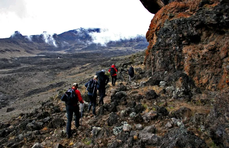
Longest • Remote • Excellent Acclimatisation
9-Day Northern Circuit
Approx. 90 km / 56 mi
Kilimanjaro's longest route circles the remote northern slopes before approaching the summit from the east, providing the best acclimatisation of all Kilimanjaro routes.
- Longest Kilimanjaro itinerary
- Excellent acclimatisation potential
- Remote northern camps and trails
- Ideal for hikers with more available time
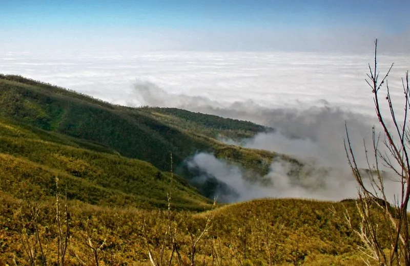
Steep • Direct • Experienced Hikers
7-Day Umbwe Route
Approx. 48 km / 30 mi
Kilimanjaro's steepest route, best suited to experienced hikers who are comfortable with a demanding ascent.
- Steep and demanding early ascent
- Best suited to experienced hikers
- Joins the Southern Circuit
- Camping throughout the itinerary
Quick Route Guide
Let our team match the route to your priorities, experience and available time
Most hikers achieve the best experience on the 8-Day Lemosho Route or the 7-Day Machame Route. Marangu, Rongai, Northern Circuit and Umbwe are excellent choices for hikers with more specific accommodation preferences, timeframes or climbing goals. If you're unsure which route is right for you, we're happy to help.
Why Choose Kilimanjaro Hiking Tours?
Why Book With Kilimanjaro Hiking Tours?
A detailed Mt Kilimanjaro map helps you understand the mountain, but the quality of your guiding team, itinerary and safety support will shape your actual experience. Kilimanjaro Hiking Tours combines experienced local guides, responsible porter standards and professional mountain support from your first enquiry to the end of your climb.
Proven Experience
15+ Years on Kilimanjaro
Our local team has more than 15 years of experience organising and guiding successful Mount Kilimanjaro climbs for hikers from around the world.
Local Expertise
Experienced Mountain Guides
Our experienced local guides know every route, campsite, weather pattern and altitude challenge, providing expert support throughout your climb.
Personal Support
Small Group Climbs
We limit scheduled groups to a maximum of 12 hikers, allowing our guides to provide more personal support and monitor every climber throughout the trek.
Acclimatisation Monitoring
Regular Health Checks
Daily pulse oximeter readings and guide assessments help monitor how each hiker is adapting to the altitude throughout the climb.
Mountain Safety
Emergency Oxygen on Every Climb
Emergency oxygen, first-aid equipment and trained guides form part of our mountain safety system on every itinerary.
Responsible Tourism
Responsible Porter Welfare
As a KPAP & KRTO partner, we support fair porter treatment, appropriate loads, nutritious meals and responsible working conditions.
Mt Kilimanjaro Map Questions Answered
Frequently Asked Questions About the Mt Kilimanjaro Map Africa
These answers explain what is shown on the Mt Kilimanjaro map, how the climbing routes connect, where hikers stay overnight and how to use the map when planning your Kilimanjaro climb.
What does the Mount Kilimanjaro map show?
The Mount Kilimanjaro map shows all seven official Kilimanjaro climbing routes, their starting gates, campsites, mountain huts, key route junctions, elevations and summit landmarks such as Gilman's Point, Stella Point and Uhuru Peak.
Can I download and print the Mount Kilimanjaro map?
Yes. A printable PDF version is available from the download button at the top of this page. You can save it to your phone or print it before travelling.
How many official Kilimanjaro routes are there?
The map shows all seven official climbing routes: Lemosho, Machame, Marangu, Rongai, Northern Circuit, Umbwe and Shira. KHT generally recommends Lemosho or Machame for most hikers, while the other routes suit more specific preferences.
Where is Uhuru Peak on the map?
Uhuru Peak is shown on the summit crater rim at 5,895 metres. It is the highest point on Mount Kilimanjaro and the final summit destination for climbers using every route.
Do all Kilimanjaro routes follow the same trail?
No. The routes begin from different sides of the mountain, although several trails later merge. Lemosho, Machame and Umbwe all join the Southern Circuit before continuing towards Barafu Camp and Uhuru Peak. The Rongai approaches from the north and descends through Marangu.
Which Kilimanjaro route has the best acclimatisation?
We generally recommend the 8-Day Lemosho Route because it combines excellent acclimatisation, spectacular scenery and one of the highest summit success rates.
Which Kilimanjaro route uses mountain huts?
Marangu is the only route with permanent mountain huts. Climbers sleep at Mandara, Horombo and Kibo huts. All other main routes use tented campsites.
What are the main summit landmarks?
The three best-known summit landmarks are Gilman's Point, Stella Point and Uhuru Peak. Routes climbing from Barafu generally reach Stella Point first, while the Marangu and Rongai summit approach reaches Gilman's Point before continuing around the crater rim to Uhuru Peak.
Which route is best for first-time Kilimanjaro climbers?
The 8-Day Lemosho Route is our most frequent recommendation for first-time Kilimanjaro climbers because it offers excellent acclimatisation and varied scenery. The 7-Day Machame Route is a strong alternative for active hikers seeking a shorter, good-value itinerary.
Why is the Shira Route not included in the main comparison?
Shira remains one of the seven routes shown on the map, but it starts at a relatively high elevation on the Shira Plateau. We generally recommend the 8-Day Lemosho Route instead because it follows a similar western approach while allowing more time for acclimatisation.
Is Mount Kilimanjaro in Kenya or Tanzania?
Mount Kilimanjaro is located entirely in Tanzania, close to the Kenyan border. Although some hikers arrive via Kenya, all Kilimanjaro climbs start in Tanzania, as every official park gate is located within Kilimanjaro National Park.
Can I use the map to navigate independently on Kilimanjaro?
The map is a planning and orientation resource, not a replacement for a licensed mountain guide. Kilimanjaro climbs must be organised through a registered operator, and hikers travel with an authorised guide and mountain crew. The map is designed as a planning resource rather than a navigation tool during your climb.
Can KHT recommend the best route for my group?
Yes. Share your preferred dates, hiking experience, available time, group size, fitness levels and accommodation preferences. Our team will recommend the most suitable route and prepare a personalised quotation.
Plan Your Kilimanjaro Adventure
Ready to Plan Your Kilimanjaro Climb?
Whether you're comparing routes, planning your itinerary or deciding when to climb, our experienced team is here to help. At Kilimanjaro Hiking Tours, we'll answer your questions, recommend the route that best suits your experience and goals, and help you choose the itinerary that gives you the best chance of reaching Uhuru Peak.